(*Names may have been changed to protect the privacy of the owners. Mainly because I desire future favors from them. ![]() )
)
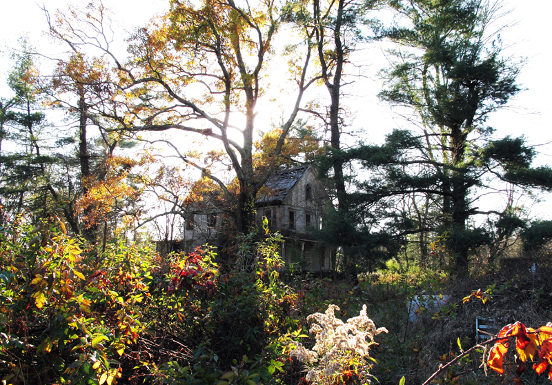
This is the house that the owner claims is the only structure out of 80+ that can't be saved after decades of neglect. The part of the house that you see to the far left is the part that has split off from the rest of the house and is now beginning to fall in on the rest. If you look closely at the roof, you can see where the carnage started.
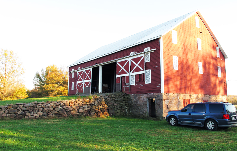
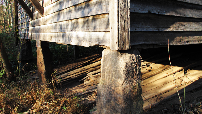
This is the Ramp Barn, circa 1840 or so. Stables in bottom (with new hot water showers, wow) and utterly stunning upstairs.
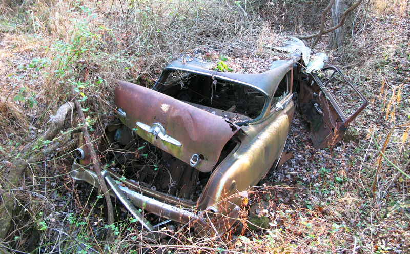
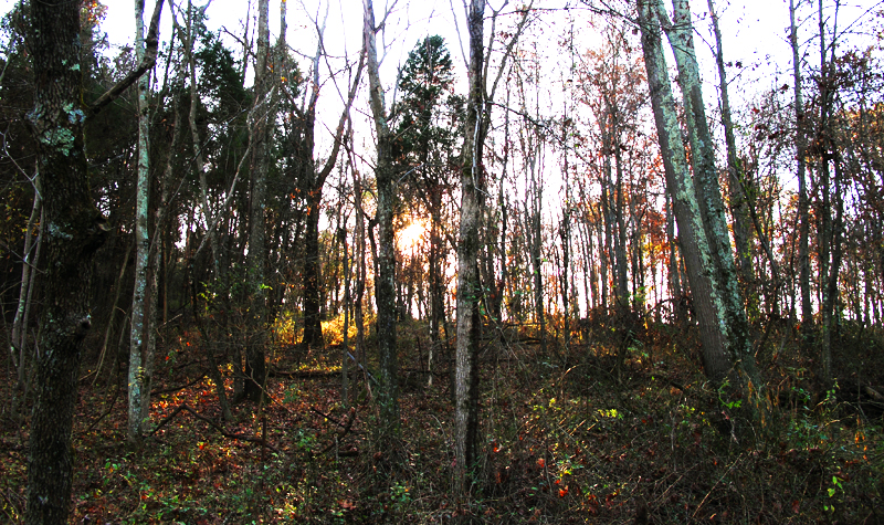
On a walk in the woods nearby I spotted something off the trail in a creek:
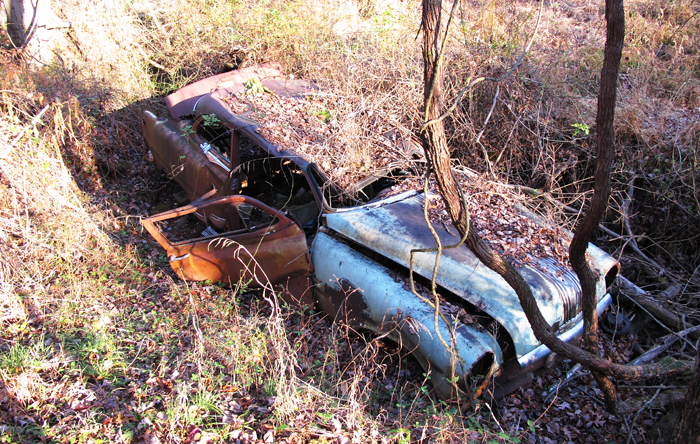
I have to admit that I couldn't fathom how the car had gotten there. We were hundreds of yards into some fairly thick woods (note the thickness of the grape vine in the foreground) and the creek bed was about 5-6ft deep. Either it was dropped there from a crane (or helicopter) or it was wrecked there when it was new & the forest grew up around it.
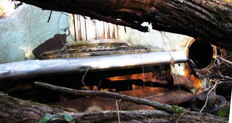
That'll buff right out.
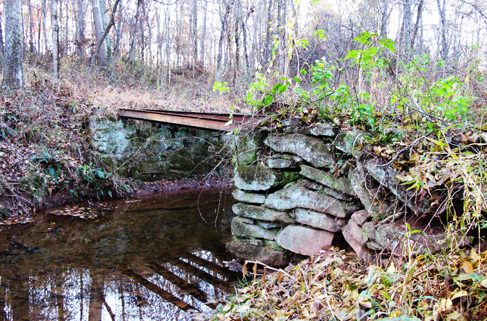
This is the foundation of the so-called Bridge House. The foundation is definitely old enough to date to the Civil War & the construction is right, but someone unfortunately attempted (and abandoned) a poor remodeling at some point (the braces you see in the upper left are holding up the bottom of a very hideous semi-modern bay window).
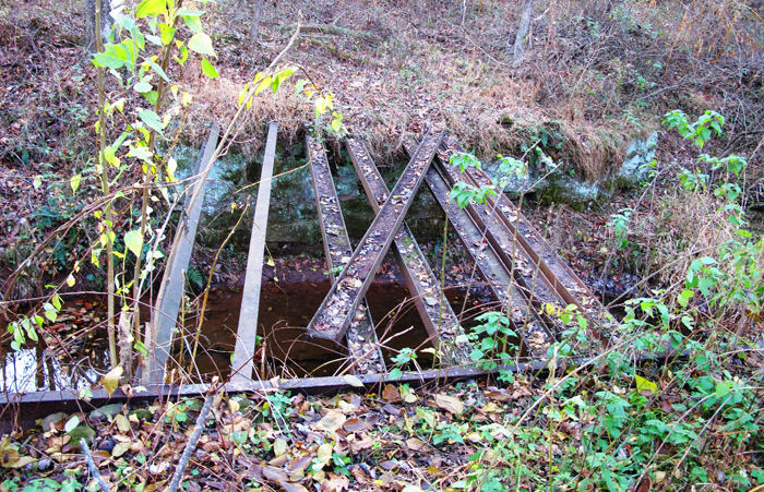
This is the Civil War Bridge, apparently used to moved cannons (as evidenced by the shear number of I-beams). I have no idea whether it was Union or Confederate and I'm sure no one else does either: This land was held for over 8 generations by a very private (and very crazy) family and has only recently been liberated from exclusion.
The bridge top (most likely wooden) is long gone & the beams are pretty thoroughly degraded, but it was obviously made to support some serious weight.
Up the ridge from the bridge, the battlements can still be seen where soldiers dug in after clear-cutting a 270deg view out of the surrounding countryside. Or so I'm told. No trail remains to the top of the ridge and with my fellow explorer having already trudged about 2 miles on muddy trails in heels, I decide not to push my luck. However, the satellite view on Google shows some interesting anomalies in the fields & at the ridge line.
And after the episode of Antiques Roadshow I saw tonight, I need to beg them to let me go over the field with a metal detector: Civil War belt buckles can go for up to $50k and metal detecting is completely illegal on all State & Nat'l Park land. (Which is one of the factors driving the cost up: shear rarity.) Could be sitting on a fortune there...
Hey Dad, can you tell me what this machine does/did:
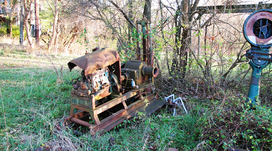
I have a guess, but I can't explain many of the features...
Now, looking at the few images here, I wish I'd taken more pics while I was there; So much cool stuff. Now I just need to find some excuse to go back and con someone into letting me take out one of the Honda CFRs and really exploring the place... That would be beyond a fucking blast. ... I get misty just thinking about it...